Where to plant: parks and streets in the lowest tree-density areas
Building on the native-oak density work in the project Native Oaks Coverage, we overlaid park boundaries and road centerlines on the 1000 ft tree-density grid to find where planting effort would close the biggest gaps — public parks and streets that currently sit in the lowest-density (<0.2 trees/acre) areas.
Parks
Park boundaries came from the California Protected Areas Database (CPAD). Ranking parks by acres of overlap with low-density cells surfaces the city's large open-space parks first, since they have the most plantable area:
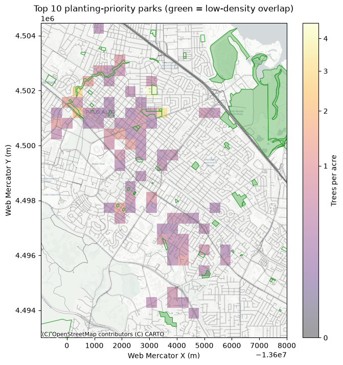
- Baylands Preserve
- John Lucas Greer Park
- Mitchell Park
- Baylands Athletic Center
- Esther Clark Park
- Hoover Park
- Robles Park
- Ramos Park
- Seale Park
- Terman Park
Streets
Road centerlines came from Caltrans' public roads network. Ranking by absolute overlap length favors long arterials just because they're long, so instead we ranked by the percentage of each street's own length that falls in low-density cells — surfacing short residential streets that are entirely under-canopied:
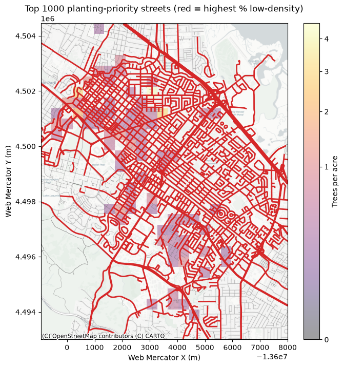
- E Meadow Cir
- Paloma St
- Ferne Ave
- Robb Rd
- Van Auken Cir Spur 1
- Stern Ave
- Stockton Pl
- Los Palos Ave
- Loma Verde Ave
- Barbara Dr
Splitting the ranked list into tiers shows how quickly priority drops off: the top 200 streets (red) versus the next 800 (lighter orange) by percentage of low-density overlap.
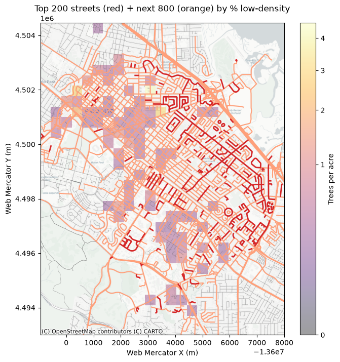
215.5 of the 496.5 road miles and 282.6 of the 2,206.1 park acres in the study area (Palo Alto and immediate neighbors) fall below the 0.2 trees/acre threshold, after excluding grid cells with no tree data at all (e.g. bay marsh, freeway) that were previously counted as low-density by mistake — still a lot of room for native oak planting, just a more accurate picture of where.